October 13, 2025

The Cheviot & Hedgehope Hill: A Two-Summit Day in the Northumberland Hills

Tackle The Cheviot and Hedgehope Hill in one rewarding loop. This trail guide covers route info, distance, difficulty, and expert tips for a wild Northumberland day out.

The Cheviot & Hedgehope Hill: A Two-Summit Day in the Northumberland Hills

If you’re in the mood for a big day out away from the crowds, look no further than the wild expanse of The Cheviot Hills. The classic route up The Cheviot (815 m) and its shapely neighbour Hedgehope Hill (714 m) serves up solitude, soft ground, and big-sky views.

This guide gives you everything you need to bag two of the North East’s highest peaks in a single circular walk—ideal for experienced hillwalkers and anyone looking to tick off England’s most northerly summits.

Quick Overview

  • Location: Northumberland National Park

  • Peaks: The Cheviot (815 m), Hedgehope Hill (714 m)

  • Route Type: Circular

  • Distance: ~15–17 km (9.5–10.5 miles)

  • Time Required: 5.5 to 7 hours

  • Difficulty: Moderate to challenging (boggy, remote)

  • Start Point: Langleeford, Harthope Valley

  • Navigation: Map essential in poor visibility

  • Good For: Two-peak day walks, Wainwright completers, solitude seekers

Getting There & Parking

The walk begins at Langleeford, a remote spot at the end of the Harthope Valley road west of Wooler. You’ll find limited roadside parking, but no facilities.

  • Nearest postcode: NE71 6RG (Wooler)

  • Parking Tip: Arrive early—only a handful of cars can park comfortably

  • Public transport: None direct—closest bus routes stop in Wooler

Route Description

Section 1: Langleeford to Scald Hill

The trail begins gently as you head south from Langleeford on a grassy track. The ascent is steady, leading you first to Scald Hill (546 m)—a minor summit but a great warm-up and viewpoint.

  • Terrain: Grassy with some rocky sections

  • Views: Harthope Valley opens up quickly behind you

Section 2: The Cheviot via Flagstone Path

From Scald Hill, the climb steepens slightly as you move onto moorland terrain. Approaching the plateau of The Cheviot, you’ll meet the infamous flagstone path—a welcome relief across otherwise boggy peat hags.

  • Summit: Flat and grassy, with a trig pillar set on a stone plinth

  • Views: Limited from the summit itself—it’s more about the feeling of height and isolation

  • Tip: This area can be featureless in cloud—navigation tools are essential

Section 3: Across to Hedgehope Hill

The descent off The Cheviot is more rugged. You’ll skirt across Comb Fell on rough, uneven ground, with deep heather and patches of bog. Eventually, you’ll start to climb again toward Hedgehope Hill—the more shapely of the two and arguably the better viewpoint.

  • Summit: Clear, with panoramic views across the Northumberland coast, the Pennines, and even the North Sea on clear days

  • Feels wilder and quieter than The Cheviot

Section 4: Descent to Langleeford

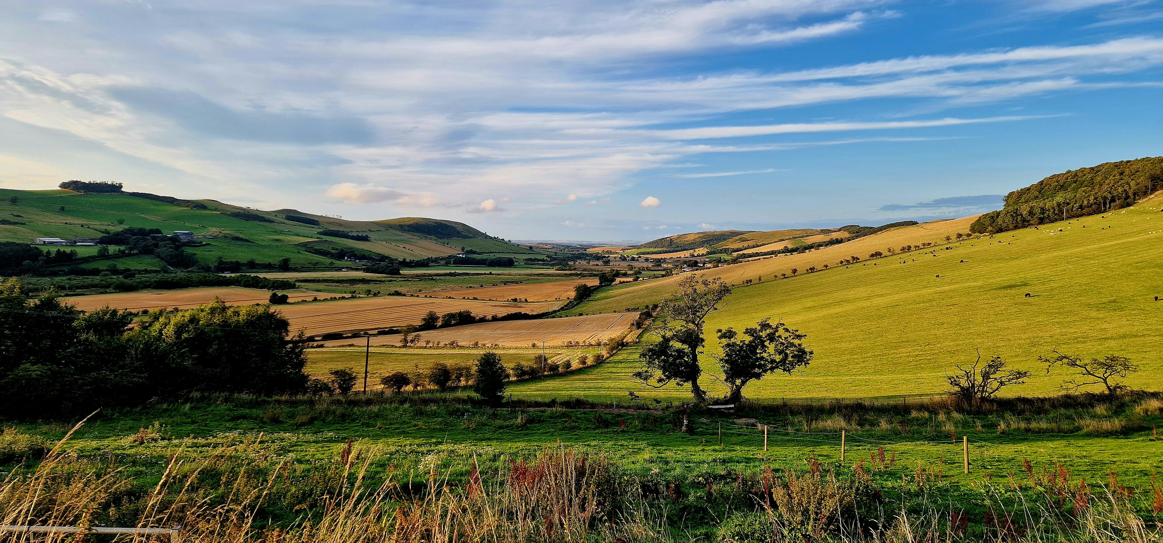
The descent off Hedgehope is steep and grassy. It can be slippery after rain, so take your time. The path eventually rejoins the valley floor and leads back to your starting point at Langleeford.

  • Total Distance: ~15–17 km depending on route variations

  • Estimated Time: 5.5 to 7 hours

  • Terrain: Boggy sections, pathless ridges, rough moor

Navigation & Map Tips

  • Maps: OS Explorer OL16 (The Cheviot Hills)

  • GPX File: Available via Peaky Baggers or AllTrails

  • Navigation Note: This is not a waymarked trail. Use a compass and map if the cloud comes down—especially on The Cheviot’s summit plateau and across Comb Fell

What to Bring

  • Waterproof boots (essential for boggy ground)

  • Gaiters (strongly recommended)

  • OS map, compass, and/or GPS

  • Waterproof layers and windproofs

  • 2 litres of water and high-energy snacks

  • Emergency whistle and backup torch in winter

Facilities & Refreshments

  • Toilets: None at the start—nearest are in Wooler

  • Shops/Pubs: Wooler has several cafés, a Co-op, and traditional pubs

  • Accommodation: Wooler makes a great base with B&Bs and bunkhouses nearby

Wildlife & Scenery

  • Red grouse and skylarks are common

  • You may spot wild goats in the valley

  • Expect wide open views, purple heather in late summer, and serious peace and quiet

Final Thoughts

The Cheviot and Hedgehope Hill are not dramatic in the way that Scottish Munros or Lakeland crags are—but that’s part of their charm. You’ll likely have much of the day to yourself, with a vast moorland backdrop and a real sense of remoteness.

If you’re looking for a quieter kind of epic, this two-peak loop is one of England’s most underrated hikes.

📲 Don’t forget to log your summits in the Peaky Baggers app and start working your way through England’s lesser-known upland gems.

Photo by Craig Birch on Unsplash

Related posts

The Best Circular Hikes in the Peak District for Peak Baggers
Location Spotlight

The Best Circular Hikes in the Peak District for Peak Baggers

Peak Bagging Near Sheffield: Where to Start
Location Spotlight

Peak Bagging Near Sheffield: Where to Start

Glenridding to Lanty’s Tarn
Location Spotlight

Glenridding to Lanty’s Tarn