
Discover the highest peaks in Northern England including Scafell Pike, Helvellyn and Cross Fell, with a guide to England’s tallest mountains and upland summits.

Northern England contains the majority of England’s highest mountains. From the dramatic peaks of the Lake District to the broad upland plateaus of the Pennines, these summits represent the highest ground in the country.
Height shapes the character of these landscapes. Higher mountains often experience stronger winds, colder temperatures and more rapidly changing weather. At the same time, they often offer some of the most expansive views in England.
For peak baggers, climbing the highest peaks is often an important milestone. These mountains define the structure of England’s upland regions and offer some of the most memorable hill days in the country.
This guide introduces the highest peaks in Northern England and explains what makes them significant within the landscape.
The peaks included in this guide are defined by their height above sea level and their significance within their surrounding landscape. Most of England’s highest mountains are found in the Lake District, which contains the country’s most rugged terrain.
However, other upland regions also contain notable high summits. The Pennines form the backbone of England and include several peaks above 800 metres. The Yorkshire Dales also contain several high hills that rise above the surrounding valleys.
While height alone does not define a great mountain, it does influence the walking experience and the scale of the landscape.
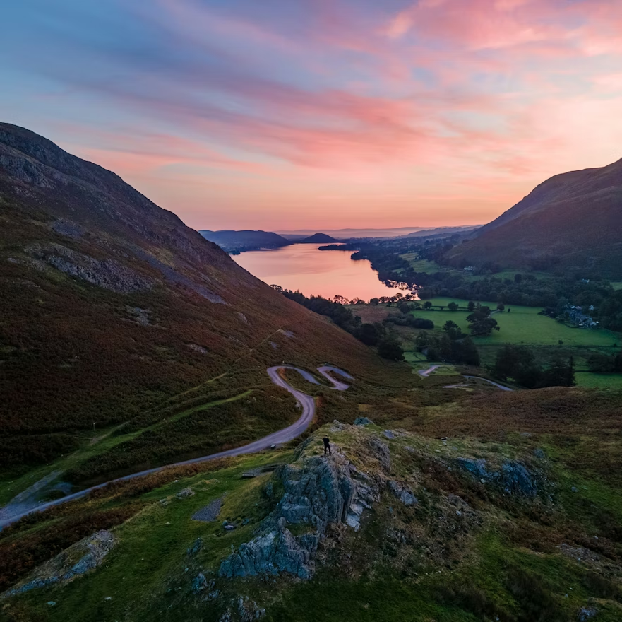
The Lake District dominates any list of England’s highest mountains. Its volcanic geology created the most dramatic terrain in England, producing steep ridges, deep valleys and high summits.
Height: 978 metres
Area: Central Lake District
Why the peak is significant: The highest mountain in England
Typical walking time: 5 to 7 hours
Difficulty: Moderate to challenging
Route style: Circular or out and back
Scafell Pike stands at the centre of the Lake District and offers views across some of the region’s most famous peaks including Scafell, Great Gable and Helvellyn.
Height: 964 metres
Area: Central Lake District
Why the peak is significant: One of England’s highest and most dramatic mountains
Typical walking time: 6 to 7 hours
Difficulty: Challenging
Route style: Circular
Scafell rises just below Scafell Pike in height but offers a more rugged and dramatic summit experience.
Height: 950 metres
Area: Eastern Lake District
Why the peak is significant: One of the most famous mountains in England
Typical walking time: 4 to 6 hours
Difficulty: Moderate
Route style: Circular
Helvellyn is well known for its ridge routes such as Striding Edge and Swirral Edge and offers wide views across the surrounding fells.
Height: 931 metres
Area: Northern Lake District
Why the peak is significant: One of the highest and most accessible mountains in England
Typical walking time: 4 to 5 hours
Difficulty: Moderate
Route style: Circular
Skiddaw rises above Keswick and provides sweeping views across the northern Lake District.
Height: 899 metres
Area: Western Lake District
Why the peak is significant: One of the most iconic mountains in the Lake District
Typical walking time: 5 to 6 hours
Difficulty: Moderate
Route style: Circular
Great Gable’s distinctive pyramid shape makes it one of the most recognisable peaks in the region.
While the Lake District contains the tallest mountains, the Pennines form the longest upland range in England. These hills are characterised by broad plateaus and expansive moorland.
Height: 893 metres
Area: North Pennines
Why the peak is significant: The highest mountain in the Pennine range
Typical walking time: 6 to 7 hours
Difficulty: Moderate
Route style: Circular
Cross Fell is one of the most remote high summits in England and offers wide views across the Pennines and surrounding regions.
Height: 848 metres
Area: North Pennines
Why the peak is significant: One of the highest Pennine summits
Typical walking time: 5 to 6 hours
Difficulty: Moderate
Route style: Circular
Great Dun Fell sits along the high ridge south of Cross Fell and is known for the large radar station near its summit.
Height: 842 metres
Area: North Pennines
Why the peak is significant: A key summit on the high Pennine ridge
Typical walking time: 5 to 6 hours
Difficulty: Moderate
Route style: Circular
Little Dun Fell forms part of the high Pennine plateau and is often climbed alongside Cross Fell.
Several other peaks across northern England reach significant heights and contribute to the region’s upland character.
Height: 828 metres
Area: Eastern Lake District
Why the peak is significant: A long summit ridge that once formed part of a Roman road
Typical walking time: 5 to 6 hours
Difficulty: Moderate
Route style: Circular
High Street offers wide views across the eastern Lake District and the Pennines.
Height: 788 metres
Area: North Pennines
Why the peak is significant: One of the highest peaks in the Pennines
Typical walking time: 6 to 7 hours
Difficulty: Moderate
Route style: Out and back
Mickle Fell lies within a remote part of the Pennines and provides one of the most isolated summit experiences in England.
Height: 716 metres
Area: Yorkshire Dales
Why the peak is significant: One of the highest hills in the Yorkshire Dales
Typical walking time: 5 to 6 hours
Difficulty: Moderate
Route style: Circular
Great Shunner Fell rises above Swaledale and offers expansive views across the northern Dales.
Higher mountains often bring more challenging conditions. Wind speeds increase with elevation, and temperatures can be significantly lower than in surrounding valleys.
Cloud and poor visibility are also more common on high summits, which can make navigation more difficult. Walkers should be prepared with suitable equipment and route planning.
At the same time, these peaks offer some of the most dramatic views and rewarding summit experiences in England.
Many of these mountains can be reached through classic walking routes. Circular routes from major valleys often provide the most satisfying days in the hills.
Ridge routes also allow multiple summits to be combined in a single outing. For example, several Lake District peaks can be linked along high ridges, creating memorable mountain days.
Weekend trips often provide the best opportunity to explore multiple high summits in the same region.
This guide is ideal for peak baggers working through England’s highest mountains. It is also useful for experienced walkers planning trips to the Lake District or Pennines.
Walkers interested in the geography of England’s upland regions may also find these peaks a useful way to understand the structure of the landscape.
Track the highest peaks in Northern England, record your summit climbs and build your personal peak bagging list with Peaky Baggers.
The highest peaks in Northern England reveal the full scale of the region’s upland landscapes. From the rugged mountains of the Lake District to the broad Pennine plateaus, each summit offers a different perspective on England’s highest ground.
Photo by Calum Flanagan on Unsplash

.png)