
Planning to hike Great Gable from Seathwaite? This trail guide covers the full route via Sty Head Pass, with tips, distance, terrain, and summit highlights.
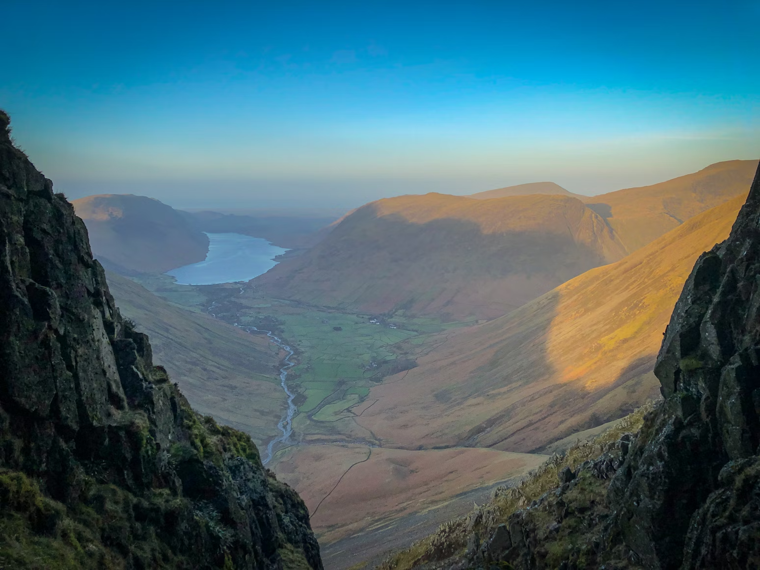
Towering above Wasdale and Borrowdale, Great Gable (899 m) is one of the most recognisable peaks in the Lake District. Often described as the mountain that looks most like a mountain, its compact pyramid shape is a magnet for fellwalkers—and the route via Sty Head Pass offers one of the most scenic ways to the top.
This guide walks you through the route, what to expect, and how to plan your day on one of Lakeland’s most iconic fells.
• Location: Western Lake District, near Borrowdale
• Height: 899 m
• Route Type: Out-and-back (optional circular with Green Gable)
• Distance: ~10–11 km (6.5 miles)
• Time Required: 4.5 to 6 hours
• Difficulty: Challenging (steep, rocky, some loose ground)
• Start Point: Seathwaite, Borrowdale
• Good For: Wainwright collectors, experienced walkers, history lovers
The walk starts from Seathwaite, a small hamlet at the end of a single-track road from Seatoller. There’s free roadside parking but no official car park, so it fills up early—especially on weekends or bank holidays.
• Nearest postcode: CA12 5XJ
• Tip: Arrive before 9 am to guarantee a space
• Public transport: Limited—nearest regular bus stop is at Seatoller, around 2.5 km away
The route begins on a well-defined track alongside Styhead Gill. You’ll pass waterfalls and grassy banks as you steadily gain height towards Sty Head Tarn—a great rest point with views back down the valley.
• Terrain: Gravel and rocky path, occasionally boggy after rain
• Distance so far: ~4 km
• Time: 1.5–2 hours at a steady pace
You have two options from here:
Option A: Windy Gap (north route)
• Steep, loose scree
• Ascends between Great Gable and Green Gable
• More direct but harder underfoot—take care in descent
Option B: Aaron Slack (southwest approach)
• Slightly longer, less loose
• Ideal for ascent or descent depending on preference
• Fewer walkers than Windy Gap
Whichever path you choose, both will bring you to the boulder-strewn summit plateau.
At the top of Great Gable, you’ll find a trig point, cairns, and the Fell & Rock Climbing Club war memorial plaque. The views are phenomenal on a clear day:
• To the south: Wasdale and Scafell Pike
• To the north: Derwentwater, Skiddaw, and Blencathra
• To the west: Ennerdale and Pillar Rock
• To the east: Green Gable and the Borrowdale fells
Optional Return: Add Green Gable
For a satisfying circular route, descend via Windy Gap and climb the neighbouring Green Gable (801 m). This adds around 1.5 km and another Wainwright tick to your day.
Return to Sty Head Tarn and retrace your route back to Seathwaite.
• Map Required: OS Explorer OL6 / Landranger 89
• Navigation Notes: The path is cairned but rocky—visibility can drop fast near the summit, so a map and compass are essential in poor weather
• GPX Download: Available through walking apps like Peaky Baggers, WalkLakes, or AllTrails
• Toilets: None at Seathwaite—nearest are in Rosthwaite or Seatoller
• Shops/Cafés: Stop at the Flock-In Café (Rosthwaite) or Glaramara Centre
• Pubs: The Scafell Hotel or Langstrath Country Inn for a post-hike pint
• Walking boots with ankle support
• Extra layers and waterproofs—summit often windy and exposed
• Walking poles recommended for steep sections
• Bring 1.5–2 litres of water and high-energy snacks
• Avoid in icy conditions unless you have winter experience and equipment
Great Gable via Sty Head Pass is everything a Lake District hike should be—scenic, steep, and full of character. With its dramatic profile and summit views, it’s a must-do for any serious peak bagger. And with the option to extend your day via Green Gable, it’s easy to turn a single summit into a small adventure.
Don’t forget to log your peak on Peaky Baggers—track your Wainwrights and keep your summit list growing.
Photo by James Qualtrough on Unsplash


